More satellite images are included in the prospectus document.
Related pages
About the project | Maps and satellite images | Finds and latest results »
 East Cleveland topography East Cleveland topography
The East Cleveland coastal plain towards the north-west, from Boulby towards Teesside and the south Durham coast. Street House Loftus is to the centre right, Eston and Upleatham Hills centre left. |
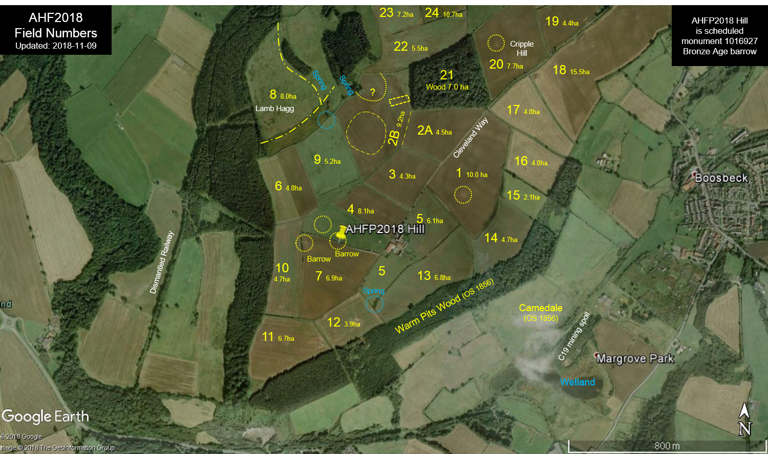 Airy Hill, Boosbeck Airy Hill, Boosbeck
Field numbers and significant topographic features. Note that the land on either side of the Cleveland Way is privately owned and farmed. Please do not enter. |
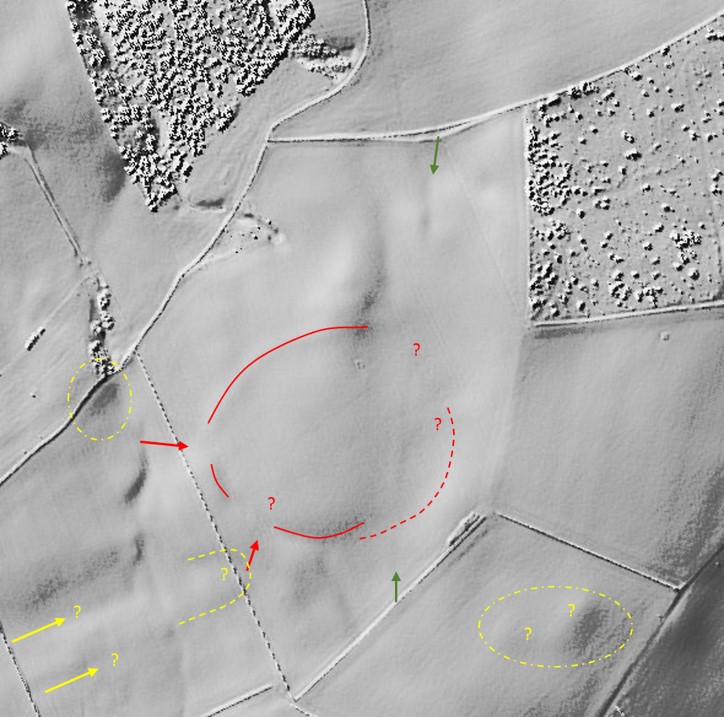
 Airy Hill Airy Hill
Some archaeological features and potential features visible in Google Earth satellite images over several years and in different agricultural seasons.
|
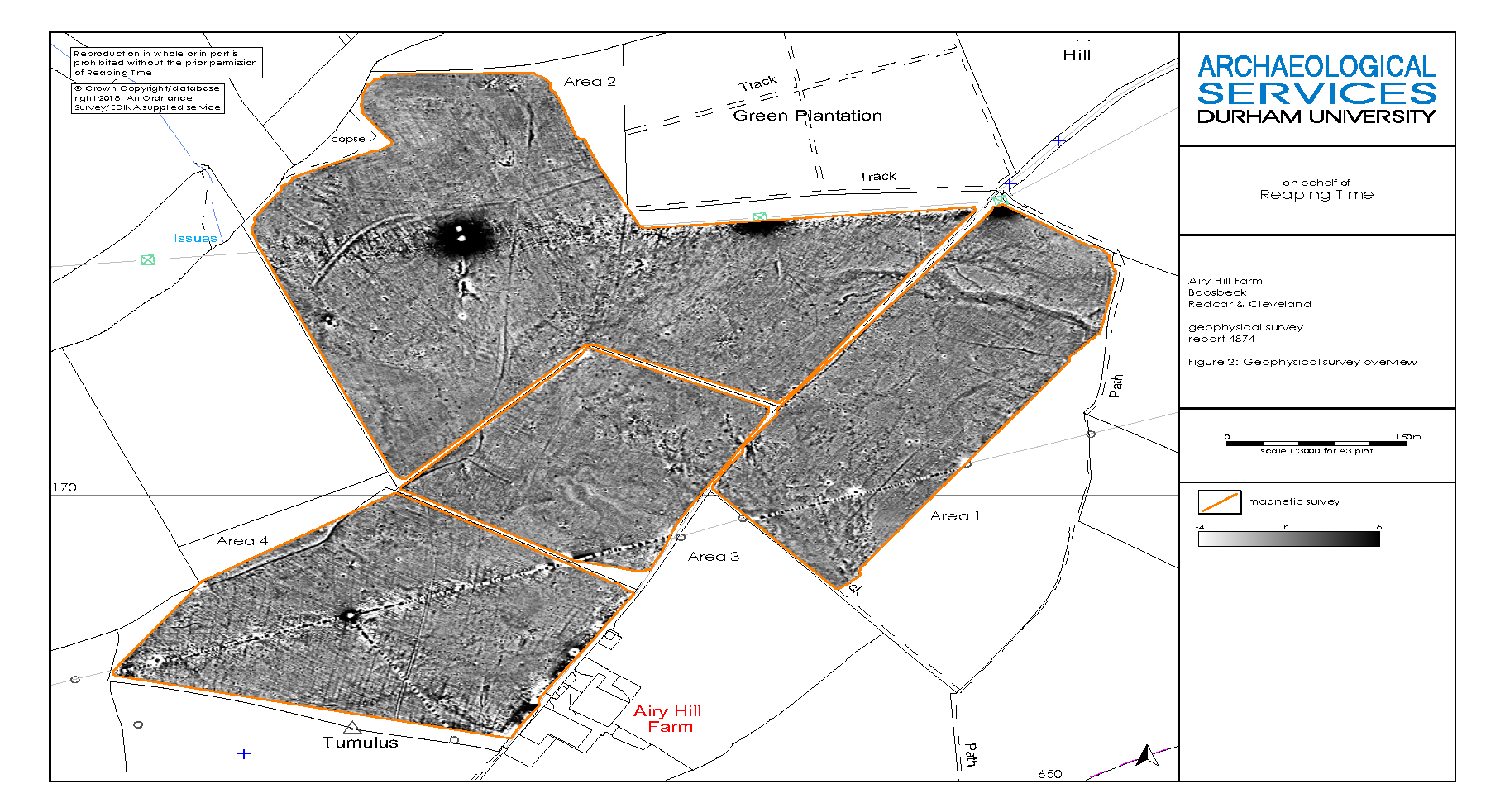 Geophysical survey Geophysical surveyIn August 2018 we conducted a geophysical magnetic susceptibility survey of more than 30 hectares using a quad bike and antennae trailer. In addition to two lightening strikes, archaeological features include circular structures, likely barrows and roundhouses, as well as enclosures, pits, legacy field boundaries (some likely prehistoric) as well as medieval and post-medieval ridge and furrow ploughing. Analysis and interpretation is underway so that we can identify priority areas for test-pit excavations and sediment coring. The dark ovals in the picture are electricity pylons and a telecoms mast (magnetic).
|
 Airy Hill and environs Airy Hill and environs
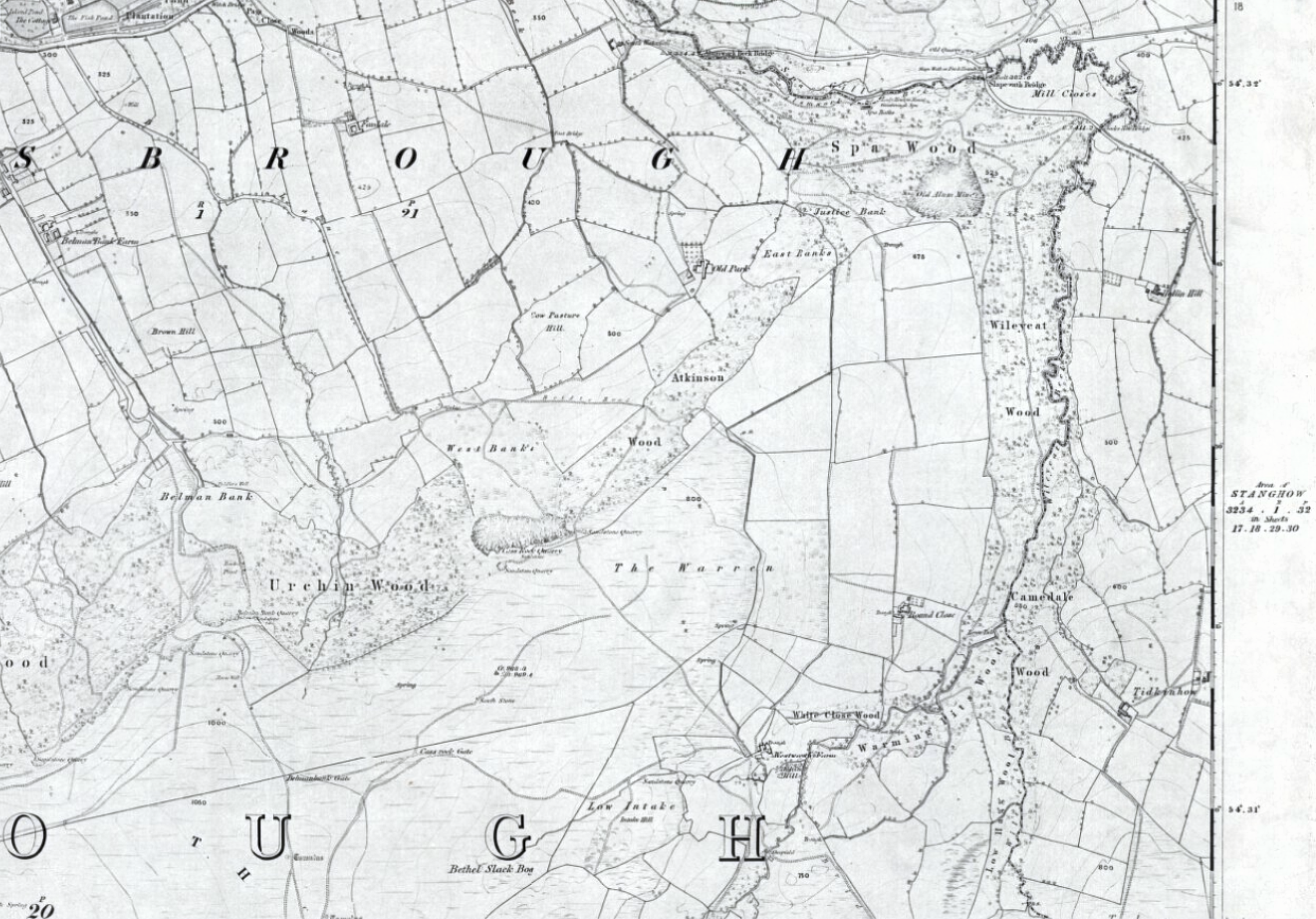
OS Map from an 1852 survey, published in 1856 with some interesting historical names such as Camedale and Warm Pits Wood. |
 Airy Hill and environs Airy Hill and environs
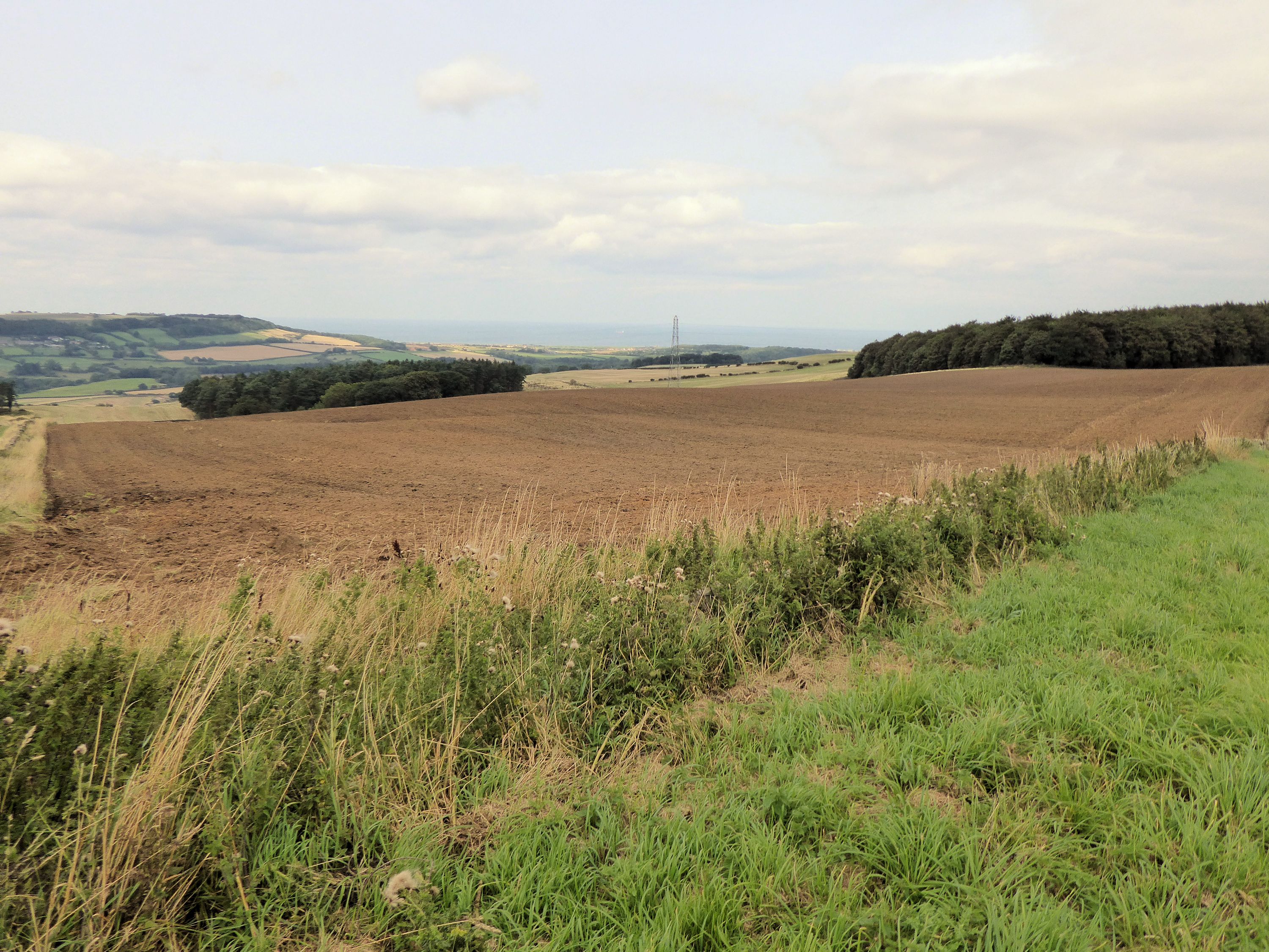
A view towards the north across field 2B (enclosure, pylon centre), facing Upleatham Hills and Marske on the coast, Aug-2018. |